 Growth Management Law Change
Helping Washington County Municipalities Plan Their Future

 Towns without a Comprehensive Plan that is consistent and locally adopted are ineligible or disadvantaged when applying for state and federal grants. Local land use ordinances based on expired Comprehensive Plans can also be successfully challenged in court.
The WCCOG site also hosts an on-line library of Comprehensive Plans in Washington County. When you visit the on-line map and select an individual town you can see the status of the Comprehensive Plan relative to the Growth Management Act and you can link directly to the Comprehensive Plan web page for that specific town.
As Comprehensive Plans expire and updates are needed the cost on towns is high and all funds to help are no longer available.
Rule Changes
The Criteria Rule (Chapter 208) used to review local Comprehensive Plans for consistency with the Growth Managerment Act was revised on August 6, 2011. Testimony from the Washington County Council of Governments and several other regional councils sought to allow adoption of regional data sets and policies specifically to replace local topic areas with regional data sets. This change should reduce the burden of re-creating or repeating the creation of the material in local Comprehensive Plans. A new definition in the new Criteria Rule for an “Adopted Regional Plan” recognizes the creation of regional data and policy and should encourage municipal participation in drafting them.
HUD-DOT-EPA funds supporting the GROWashington-Aroostook regional planning initiative were used to create on-line mapping services in Washington County to relieve the burden on town officials to provide this information to the public, use it to develop local Comprehensive Plans and assist lay boards with development review.
Public Parcel Viewer Tool
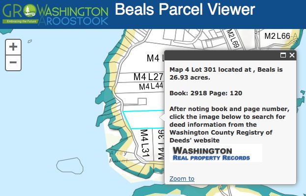
 A Public Parcel Viewer provides parcel map and assessment information for all Washington County towns.
Users can search by address or parcel number then zoom to the parcel. After noting the Book and Page Number, click the link to the Washington County Real Poperty Division to download recorded deed information.
Public Parcel Map Instruction Guide here. HELP is available on-line (screen upper right) too.
Planners Maps Tool
The Planners Maps provide a more sophisticated web map to Planning Boards and Code Enforcement Officers for planning and regulatory review.
They have the same information (parcels) as the Public Parcel Viewer plus the followng:
- Shoreland Zoning
- Wetlands
- Conservation Lands
- Proposed Land Use from municipal Comprehensive Plan (if available)
- Development infrastructure
- Public Services
- Brownfields sites in varying stages of assessment and redevelopment
- Agricultural soils, farms (under development)
- Clams, Economy and Land Use (under development)
The on-line maps have a help function available with each map (screen upper right); users can also download the Planners Map Instruction Guide here.

Share this content: